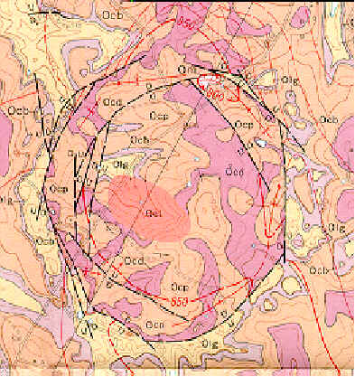
This is a nearly 1 mile diameter circular ring of subsurface cracks and sink-holes, on Big Sink Road about 3 miles northeast of Versailles. The impact happened after the Ordovician since these layers are sheared. The age is only roughly known to be less than 445 million years.
How to get there from Lexington: Leave Lexington on Versailles Road. Passing Calumet on the right, the airport on the left, and the Castle on the right, proceed to the Versailles by-pass, Route 60 West, 8 miles past New Circle Road. Proceed on the Versailles Bypass to the second traffic light, and turn right on Big Sink Road. You pass the south rim 2.7 miles after turning. At 3.1 miles you pass the region marked as "intensely breciatted limestone".
Part of the U.S. Geological Survey Quadrangle Map 325 of the area is shown below.
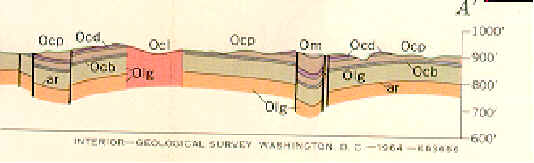
Below is a map of the sub-surface structure along the diagonal line in the map above.
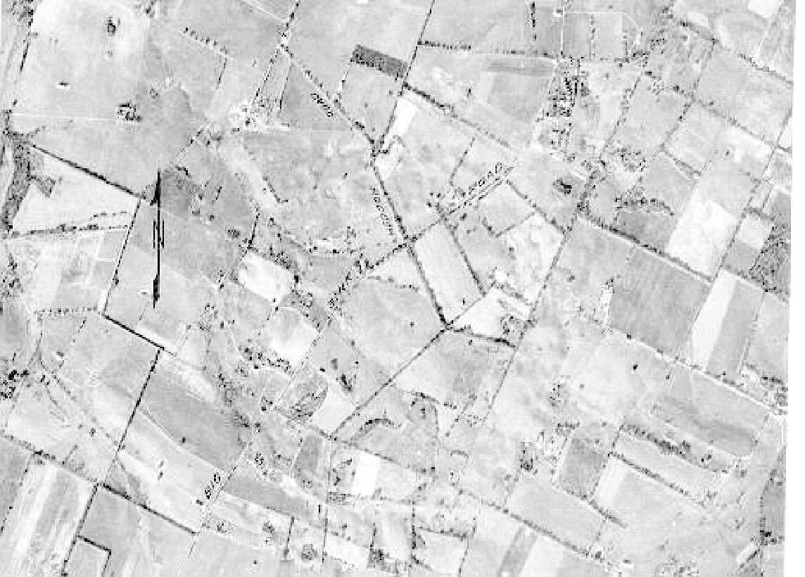
Below is a photograph taken from 20,000 ft. The sinkholes are visible and form a nearly perfectly circular pattern. Big Sink Road is visible running from lower left to upper right. PHoto from 1965 Geological Society of Kentucky Field Trip, based on US Geo Survey Prof Paper 501-B, by Douglas F.B. Black.
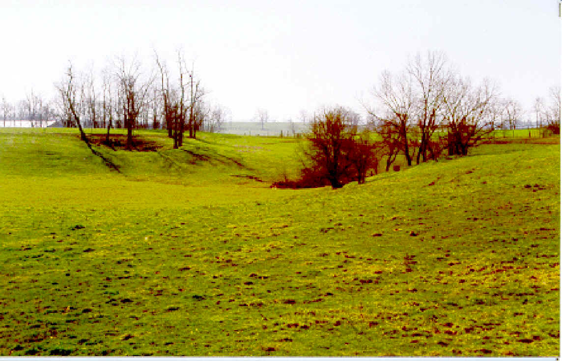
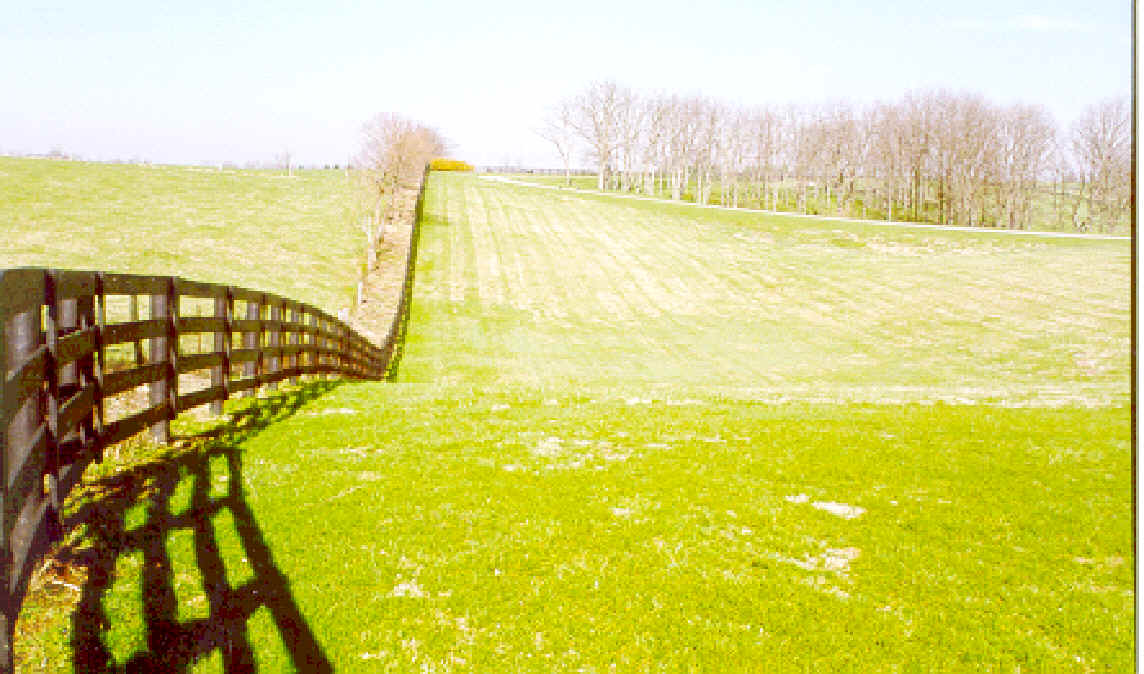
These are pictures of the sink holes that form the large circle above.